 29, 30 NOV
 & 1 DEC 2026
 29, 30 NOV
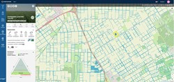
 Boer&Bunder brings agricultural and geospatial data together on one map: fields, crop history, field area, soil and elevation data. See at a glance what was grown on a field in recent years, useful for crop rotation planning and for assessing land to rent or buy. Satellite imagery shows crop development and in-field variation, and early warnings combine field and weather data to flag higher disease risk. Share fields easily with contractors, employees and advisers. An accessible first step into precision farming, without hardware.
Check our website and test for free at: https://boerenbunder.nl/